Posted by: Jessie | 7 May, 2009

A Pause to Reflect

Here we are in Buenos Aires–again–which is a weird feeling. For one, we’ve been here before, so we know things about this city, like how to use the metro, where to get amazing bbq ribs, and how to orient yourself in relation to the Obelisk. So there’s a familiarity… an alien feeling to us backpackers, accustomed to bouncing from unknown to unknown. But more than that, it symbolizes a coming full circle. It is our last stop on this continent, before we fly to Central America for a short stop on our way home. We’ve got an apartment here, so much of this is reminiscent of home: the familiarity of the city, the space we call our own every night, the approaching return flight that hangs over us. For whatever reason or combination of reasons related to these, I have been mentally composing two lists:

THINGS I WILL MISS ABOUT SOUTH AMERICA AND/OR BACKPACKING

1. This has to top the list: $3 bottles of wine. Not just any wine. Good wine. REALLY good wine tops out around $10.
2. Seeing dogs (and cats) everywhere. Read More…

Ahhh, Bariloche. There are so many wonderful things to remember about our brief stay in this small city. We thought it would be hard to top El Bolsón, and I suppose we didn’t, really. (I mean, those waffles, come on!) Bariloche is only two hours north of El Bolsón in the foothills of the Argentine Andes, in the Lakes District, and by all accounts Bariloche is the more visited, more touristy big brother to the smaller hippie town. Almost every backpacker in Argentina passes through Bariloche. So we were afraid it might be something of a simulacra-town, like Pucón in Chile, constructed for and by tourism. But we were pleasantly surprised; In the battle of the B-towns, Bariloche gave Bolsón a better run for its money than we had hoped it would. Much of this had to do with our hostel:

How you know life is good: Sunset, from our hostel balcony.

How you know life is good: Sunset, from our hostel balcony.

There’s nothing like a penthouse hostel. In fact, the hostel is probably responsible for at least 75% of our warm fuzzy feelings about Bariloche. Hostel 1004, as it’s called, has been installed in one half of the top floor of an apartment building. This gives it an entirely distinct feel Read More…

Posted by: Kevin | 14 April, 2009

El Bolsón: The Charms of Hippiopolis

Between the penguins and the ice cream, the seaside strolls and the abundant sunshine, Puerto Madryn was a tough act to follow. We again found ourselves jumping from the shore to the mountains but, unlike Chile, that required an overnight bus and nearly a thousand kilometers. We had set our sights on El Bolsón, a smaller town in the Argentine Lake District that stands apart from, well, just about every other city in the country. Sometime in the late 1950’s, El Bolsón became a hippie mecca almost overnight. Even through the ugly years of military dictatorship and the Dirty War, the town was able to maintain a surprisingly liberal, surprisingly open culture: for instance, it was the first place in South America to declare itself a “non-nuclear zone.” Nowadays, its a mixing pot of people–mostly hippies–from all over South America and the rest of the world. It gets some spill-over tourism from the more posh Lake District towns to the north (notably, San Carlos de Bariloche) but mostly sticks to its hippie roots, for better or worse.

Early morning, arriving in El Bolsón.

Early morning, arriving in El Bolsón.

Rather than writing yet another long-winded narrative of what we did, what we ate, who we offended, etc., I thought I’d mix things up and offer another Valdivia-entry-style pastiche of the town. So here, for your amusement, is a brief record of The Charms of the Hippiopolis…

Read More…

Driving north through vast, empty Argentina, towards warmer climates

Driving north through vast, empty Argentina, towards warmer climates

(PENGUIN PICTURES AHEAD!)

Getting off the bus in Puerto Madryn immediately changed my whole attitude about traveling. This was due almost entirely to one fact: it was warm. 33 hours and 3 different buses had safely put something like 1200km between us and the dark, blustery “end of the world” where we hiked through snow and gritted our teeth through mad sleety dashes to get food. The deep south had disappeared in the rear view.

A note about buses: As far as South America goes, you just can’t beat Argentina. They run regularly, and always when they say they will. The seats are comfortable and tilt back enough that you can actually sleep. They show movies, admittedly of… varied… quality. And if you shell out an extra 20% for the “full cama” service, Read More…

Posted by: Kevin | 3 April, 2009

Punta Arenas & Ushuaia: The Ends of the Earth

Once we had braved the wilds of Torres del Paine, Jessie and I soon found ourselves struck by a sudden listlessness, a sort of travel ennui that slowly pervaded our day-to-day routine. For the previous few months, Torres had stood out as a sort of apex for our trip, and we weren’t alone: most adventure travelers regard Torres as the centerpiece of their Patagonian experience. Our previous day hikes had in some sense been training runs for our eight-day epic hike, our forays into the wilderness lead-ins to the grandeur of the Parque. Once we had it in our rearview mirror, we quickly discovered that our remaining time on the continent lacked any real shape or form. There were no sights we were as excited to see and–more than that–we had passed the mid-point in our trip (oddly enough, the same day we crested the high pass above the glacier in the park).

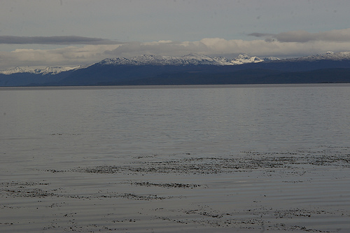
A view from the shore at the edge of the Earth.

A view from the shore at the edge of the Earth.

Read More…

··for more photos of the hike, go here.

The summary: Torres del Paine (Paine Towers) is the name of Patagonia’s most famous national park (our Brit friend Sanjima dubbed it Torres del “Pain,” and there were hours or even days where we mentally referred to it as some combination of words unfit for civilized company). Located in southern Chile, it is a vast, wild piece of land curled around a cluster of some of the most compelling peaks and glaciers the world has to offer. It is sort of astounding that such incredible sights are literally smashed together like someone collected a “best-of Patagonia” and plopped them all in one place.

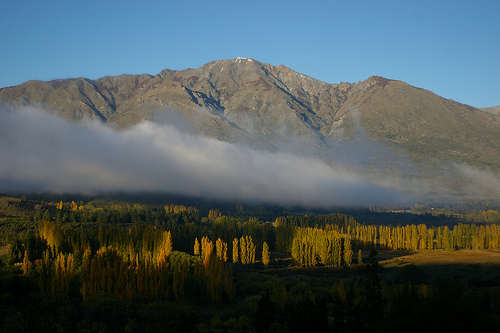
What Parque Nacional Torres Del Paine looks like as you approach

What Parque Nacional Torres Del Paine looks like as you approach

There is Grey Glacier, an enormous piece of ice that connects all the way to the massive Chilean ice fields. There are the Torres (towers) themselves, named Paine in the original native language, meaning “blue,” despite the fact that at sunrise they turn deep red. There is the Valle Francés, a gully between glaciers and mountains offering a 360-view of cliffs and snow-caps. There are sparkling teal lakes. There are enough wild, windswept Patagonian landscapes to sate a lifetime’s thirst. And there is the weather itself, coquettish and cruel, seemingly sentient, inexplicable, a force you hate and love and before which you learn to be very, very humble. It is a magical place, and it seems charged with a special energy: these heart-stopping geographies all huddled together in one place, creating their own wild weather, protected by a vast wilderness and their own impenetrability. Of the 150 km of trails in the park, we decided that, generously, 20km are flat. Torres del “Pain” punishes you for the visit; you gasp for breath on the climbs, assassinate your knees on the descents, shiver in your sleeping bag overnight, and wring out wet tents every morning. But she is well worth the Pain. Read More…

Posted by: Kevin | 15 March, 2009

El Calafate: What Happens at a Glacier at Dawn

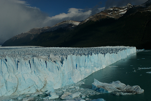
El Calafate is one of the most-visited tourist towns in all of South America, a statistic owing entirely to the presence of the massive and easily-accessible Perito Moreno Glacier just fifty kilometers outside of town. The town proper is nothing special–pricey restaurants, posh hotels for the wealthy crowd, and more souvenir shops than you can shake a stick at–and it exists almost solely as a jumping-off point for the glacier. Like Pucón back in Chile, I quickly found myself chafing at the town’s ambience (I have little love for big crowds of affluent gringos and masses of fellow backpackers, all of whom flock to El Calafate in droves), so I was more than happy to treat our visit more as a surgical strike rather than an ambling visit.

The right half of the Perito Moreno Glacier.

The right half of the Perito Moreno Glacier.

Read More…

Posted by: Kevin | 13 March, 2009

El Chaltén: Ugly Americans, Beautiful Mountains

This entry begins with the story of a couple of ugly Americans. Not us, thank God. An older American couple: a somewhat overweight guy with a beard and glasses, probably in his 50’s, and his very high-strung, very diminuitive wife. I saw them for the first time on the ferry ride to Chile Chico, when I watched the guy (I never bothered to ask his or his wife’s name) lecture a nice-looking Scandinavian guy for almost the entire trip. Then we saw them again in town when we were looking for bus tickets. We stopped to ask the aforementioned Scandinavian guy–a young Swedish med student named Hampes, very polite, very friendly–where to buy tickets, but the older American guy took it upon himself to answer us. Talking to us like we were kindergartners, he told that we had to go into an unmarked building at the end of the street and ask a guy sitting at a computer for them. So pleasant. We then had the good luck of sitting in front of them on the bus across the Argentine border, during which time the guy managed to tell us that we were wrong about (A) the possibility of a reciprocity fee for entering into Argentina on an American passport, (B) the conversion of Celsius to Fahrenheit temperatures, and (C) the likelihood of an overnight bus south to El Chaltén along the mostly gravel Route 40. He really managed to pack a lot in there, with an equal amount of pomposity and crassness, while his nervous, small-woodland-animal-like wife occasionally piped in to back him up. It was really quite remarkable. Read More…

When I left off in the last post, we had successfully fled the fishing strike and the gas shortage by going two hours south, to Parque Nacional Cerro Castillo. We got the last bus out of town and holed ourselves up in Cerro Castillo, the village that shares a name and a border with the national park, to wait out the political drama.

Villa Cerro Castillo is nothing more than one street. The remote southern Carretera Austral winds up and around the mountains in the wilderness of Chile, and at an unsuspecting moment it branches off into a lonely avenue lined with a handful of houses, calling themselves Villa Cerro Castillo. This avenue then simply peters to a stop after half a mile, having done its work of giving a postal address to 30 families. The kind of place where a child kicks a soccer ball in the dust and a stray dog wanders up and down the road before the sun sets and all living things hibernate in the dark.

Our colectivo driver (the last one in Coyhaique with gas) dropped us off in the village at his sister’s house , who had two spare rooms. We spent a lovely evening watching the last rays of sun punch through the clouds and spotlight the surrounding peaks and rivers. The hazy low clouds and the silvery river snaking off through the valley, all gave everything that quintessential Carretera Austral feel: otherworldly. For 10 minutes a ray of sun shot right into the bowl of Cerro Castillo (the park’s namesake mountain). Then the light dropped out of the sky behind the mountains and Villa Cerro Castillo went to sleep.

sun rays falling into the bowl of Cerro Castillo, which we climbed the next day

sun rays falling into the bowl of Cerro Castillo, which we climbed the next day

Read More…

Well, we had our first real transportation adventure.

Our recent posts have alluded to the difficulties inherent in traveling through–or anywhere near–the Carretera Austral in Chile. On any given day you are already facing the vast infrastructural obstacles on the largely unpaved, remote, disconnected stretch of “highway” that represents the end of the road, literally, in this country. It’s Last Chance Junction, before the road simply stops and Chile fragments into islands. It is a seductive challenge for beauty-seekers and mountain bikers alike.

But if you are us, and thus unlucky, or if you are simply a tourist in Latin America for more than a few weeks, you are likely to run into additional… geo/political headaches. The first problem was the erupting volcano in Chaitén. I wrote about that in the Puerto Montt post. So we went around the whole northern section of the Carretera, via Isla Chiloe, which was the subject of Kevin’s last post. This meant boarding a 27-hour ferry from the southern end of Isla Chiloé back to the mainland port of Puerto Chacabuco, a remote shipping stopover in the southern Carretera Austral. Seemed simple enough. Relatively speaking, of course.

We spent an extra pair of days on Isla Chiloé because the ferry (hereafter referred to by its name, the Naviera) was delayed by vague transportation-related problems at the destination port, Chacabuco. We assumed this was due to the erupting volcano to the north in Chaitén, since troubles along any one section of the Carretera Austral can have a domino effect on the rest of the region. Well, we were wrong, as you will soon see. Read More…

Older Posts »

Categories